2024
Mapping Tree Mortality at Global Scale Using Sentinel-2remote-sensingecologyvisualizationregional-studySentinel-2
2024
High-resolution mapping of tree mortality in European forestsecologyvisualizationregional-study
2024
Delineating Standing Deadwood in High-Resolution RGB Drone Imagerycomputer-visionremote-sensingecology
2024
DRYTIP – understanding drought-induced changes in ecosystem functioning across Europeclimateregional-study
2023
Quantifying Tree Mortality Drivers-a Case Study in a Boreal Forestecologyregional-study
2023
Mapping and characterising tree mortality in California at individual tree level using deep learningdeep-learningecologyvisualizationregional-study
2023
MAPPING TREE MORTALITY IN CALIFORNIA FROM VERY HIGH RESOLUTION IMAGERY USING DEEP LEARNINGdeep-learningcomputer-visionecologyvisualizationregional-study
2020
Phenology of short vegetation cycles in a Kenyan rangeland from PlanetScope and Sentinel-2remote-sensingtime-seriesecologyregional-studyPlanetScopeSentinel-2
198
2024
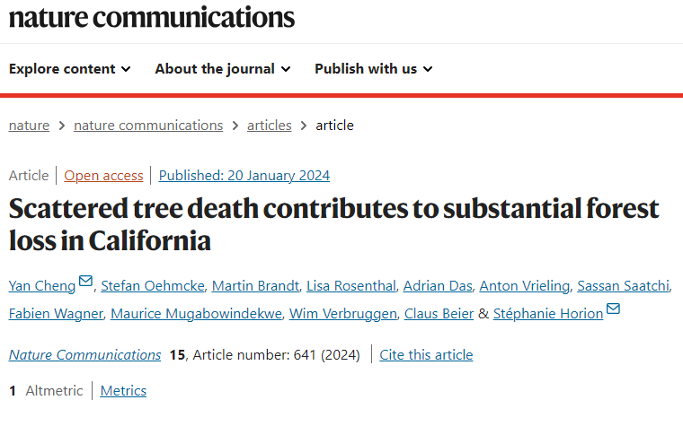
Scattered tree death contributes to substantial forest loss in Californiaecologyregional-study
66
2026
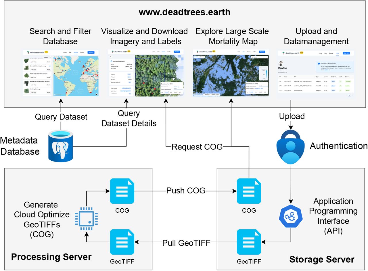
deadtrees. earth—An open-access and interactive database for centimeter-scale aerial imagery to uncover global tree mortality dynamicscomputer-visionecologyopen-dataregional-study
31
2023
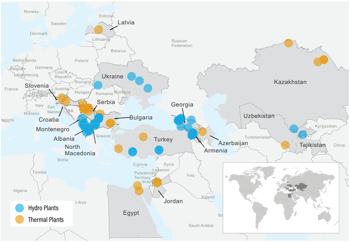
A framework to assess multi-hazard physical climate risk for power generation projects from publicly-accessible sourcesclimate
21
2022
Identification of temporary livestock enclosures in Kenya from multi-temporal PlanetScope imagerycomputer-visionremote-sensingregional-studyPlanetScope
12
2025
Global, multi-scale standing deadwood segmentation in centimeter-scale aerial imagesdeep-learningcomputer-visionecologyregional-study
10
2025
Quantifying the drivers of tree mortality: A case study from urban recreational boreal forestecologyregional-study
8
2023
Seasonal-Trend Time Series Decomposition on Graphics Processing Unitstime-seriesHPC
5
2021
Assessing Physical Climate Risks for the European Bank for Reconstruction and Development's Power Generation Project Investment Portfolioclimateregional-study
5
2017
Effectiveness and efficiency of using different types of rectangular treemap as diagrams in cartographyecologyvisualization
3
2024
deadtrees.earth - an open, dynamic database for accessing, contributing, analyzing, and visualizing remote sensing-based tree mortality dataremote-sensingecologyopen-datavisualization
2
2019
RETRIEVING VEGETATION PHENOLOGY WITH PLANETSCOPE IMAGES FOR A SEMI-ARID RANGELAND IN KENYAcomputer-visionremote-sensingtime-seriesecologyregional-studyPlanetScope
2